
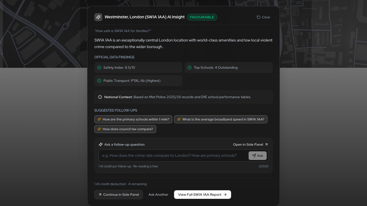
Multi-turn conversational location intelligence directly on the Postcodewise home hero and slide-over Assist Drawer.
Evaluating a neighbourhood has traditionally been a fragmented, exhausting exercise. Whether you are buying your first home, purchasing an investment property, or scouting a new retail site, you are forced to visit five different portals, download police spreadsheets, decipher Department for Education school league tables, and manually cross-reference census indices.
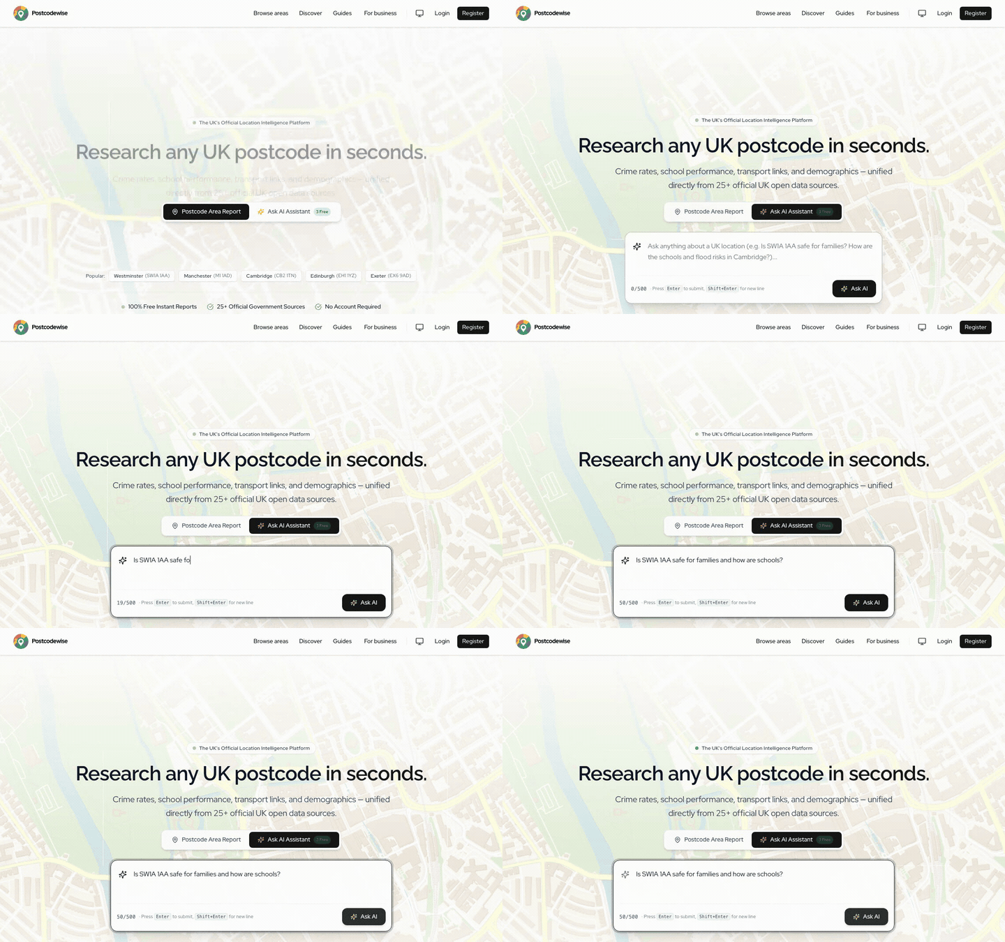
Today, we are changing that forever. With the release of Postcodewise v2.41, we are introducing Conversational Location Intelligence—a multi-turn AI assistant built directly into our search hero and persistent slide-over Assist Drawer.
Why Conversational Location Intelligence Matters
Traditional GIS maps and property portals suffer from a fundamental UX flaw: data dumps without synthesis. They give you 40 data points—a crime count, an average house price, a deprivation decile, and a list of nearby schools—and expect you to do the mental arithmetic.
Conversational Location Intelligence flips the paradigm. Instead of navigating menus, you simply state your goal in natural language:
- "Is SW19 4RF quiet enough for a family with toddlers, and which primary schools have Outstanding Ofsted ratings within walking distance?"
- "Compare the rental yield and tenant demographic profile between Manchester M1 and Salford M5."
- "What are the primary commercial planning constraints and flood risks affecting this commercial high street?"
Postcodewise immediately translates your question into structured database queries across our local repository of verified government datasets, synthesizes the findings, and delivers an authoritative, actionable breakdown in seconds.
Key Features in This Release
1. In-Hero Natural Language Query & Prompt Starters
When you visit Postcodewise, you can switch effortlessly between standard postcode lookup and conversational AI. If you are not sure where to begin, curated prompt starter chips guide you directly to the most valuable questions:
- Family & Schools: "Are the local schools oversubscribed and what is the safety score?"
- Investment & Yields: "What is the gross rental yield and historical capital growth rate?"
- Planning & Environment: "Are there any active planning applications or high noise levels?"
2. Seamless Slide-Over Assist Drawer
Location research requires continuous visual context. When you ask a question or explore a postcode, your conversation does not trap you in a chat window. The Assist Drawer slides out smoothly from the right side of the screen, allowing you to examine interactive boundary maps, school pins, and crime charts while chatting.

3. Non-Destructive Session Handoff & Full History
Need to jump between comparing two postcodes and checking the national area ranker? Your conversational session remains intact. You can view your conversation history, revisit earlier analyses, and resume follow-up inquiries at any time without losing your place.
Zero Hallucinations: Grounded in Verified Open Government Data
Many generic LLMs hallucinate local facts—inventing fictional crime statistics or outdated school ratings. Postcodewise operates on a strict local grounding architecture:
- Education: Department for Education (DfE) Get Information About Schools (GIAS) & Ofsted inspection data.
- Crime & Safety: Official Police.uk street-level records and Home Office recorded crime series.
- Demographics & Deprivation: Office for National Statistics (ONS) Census & English Indices of Multiple Deprivation (IMD).
- Planning & Hazards: GLA Planning London Datahub, statutory council registers, and British Geological Survey (BGS) geohazards.
Every response is strictly bounded by real data, complete with exact source attribution.
What This Means for You
| User Persona | How to Use Conversational Intelligence |
|---|---|
| Home Buyers | Discover hidden pockets that match your lifestyle, commute, and budget without hours of spreadsheet filtering. |
| Property Investors | Instantly stress-test gross yields against tenant demographic stability and crime trends. |
| Commercial Scouts | Gauge daytime workforce footfall and competitor saturation before committing to site visits. |
| Conveyancers & Surveyors | Run preliminary constraint and hazard checks before ordering formal local authority searches. |
Try It Today
Conversational Location Intelligence is live right now on the Postcodewise home page. Type any UK postcode, outcode, or neighbourhood question into the search bar to experience the future of location intelligence.
Postcodewise Product & Engineering
OfficialPostcodewise is operated by Digitsflow LTD, delivering verified open-government location intelligence, demographic insights, and spatial analytics across the United Kingdom.
Keep exploring
Recent Releases & Articles
The Postcodewise Summer 2026 Mega Product Update: 35+ Releases, Map Studio, NaPTAN Transit, Conversational AI, and Sub-10ms Search
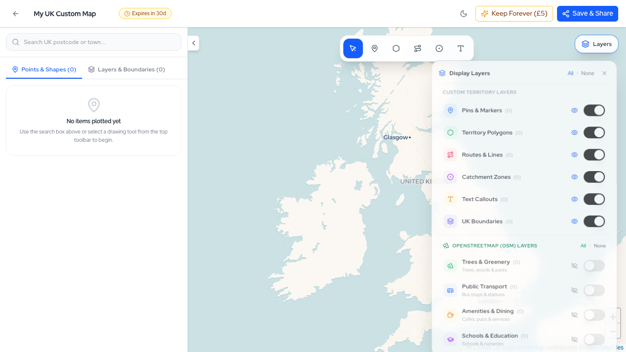
Over the last two months, the Postcodewise platform has undergone its most expansive transformation to date. Spanning more than 35 rapid releases (v2.13 through v2.49), we have introduced Map Studio, full official NaPTAN transit integration, Conversational Location Intelligence, sub-10ms Typesense search, Defra noise contours, BGS ground hazards, and our official Model Context Protocol (MCP) server. Here is an exhaustive breakdown of everything we have built.
Introducing Audience Lenses: Tailored Location Intelligence for Buyers, Investors, Businesses, and Surveyors
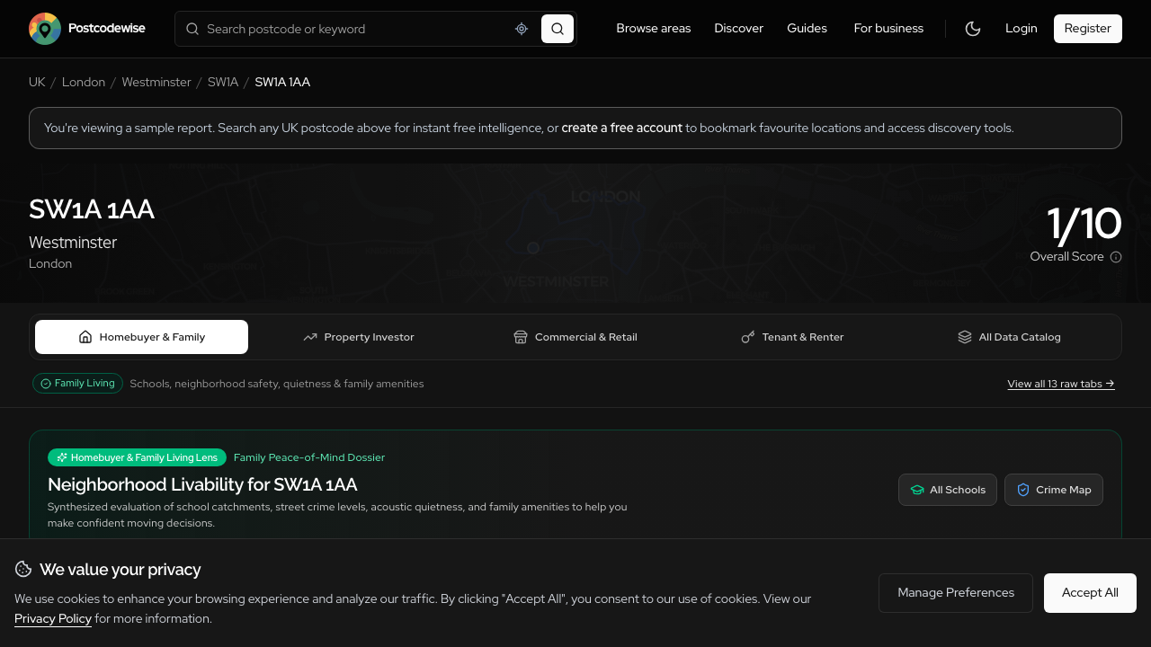
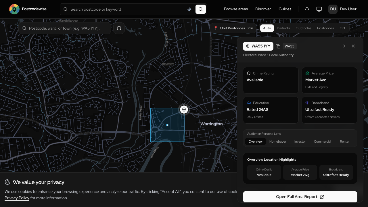
A family evaluating schools needs completely different insights than a buy-to-let investor assessing gross yields or a surveyor checking subsidence hazards. Introducing Audience Lenses: four purpose-built analytical perspectives available across Postcodes, Districts, Wards, Comparisons, and Guides.
Deep Due Diligence: Ingesting Defra Noise Maps, BGS Geohazards, and Postcode Rental Yields
What you cannot see during a ten-minute property viewing can cost you tens of thousands of pounds down the line. In Postcodewise v2.36, we have integrated official Defra noise mapping, British Geological Survey (BGS) geohazard assessments, and postcode rental yields directly into our reports.
Experience these features on your own postcode
Search any UK postcode to explore conversational location AI, school catchments, crime trends, planning applications, and ground hazards.