
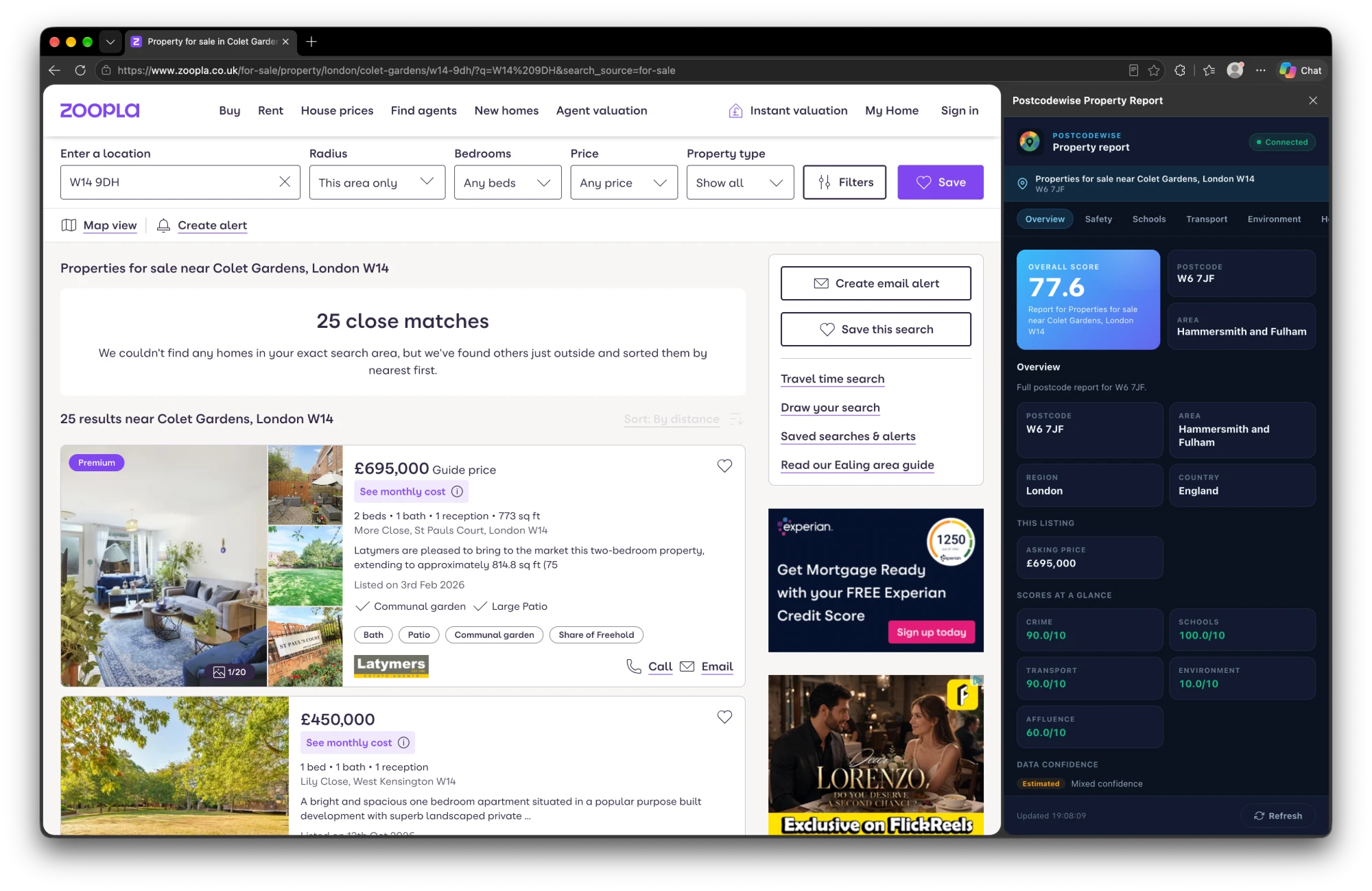
The Postcodewise side panel beside a Zoopla search: overall score, area details and crime, schools, transport and environment scores for the listing postcode.
Property portals tell you about the house. They say very little about the street it sits on. Until now, answering "is this a good area?" meant opening a new tab for every listing and copying the postcode into a report.
The Postcodewise browser extension is now live, and it removes that step. Browse a listing and a side panel opens beside it with the area intelligence for that postcode, already loaded.
What it does
When you open a listing on a supported portal, the extension reads the address and postcode from the page and loads the matching Postcodewise report in a side panel. There is nothing to copy, paste or search.
The panel opens on an Overview with the overall score, the postcode, local authority area, region and country, and, where the listing shows one, the asking price. Below that are at-a-glance scores for crime, schools, transport, environment and affluence, with a data-confidence indicator so you can see how much to trust each figure. Tabs take you deeper into each topic.
Where it works
Listings are detected automatically on:
- Rightmove (rightmove.co.uk)
- Zoopla (zoopla.co.uk)
- OnTheMarket (onthemarket.com)
- PrimeLocation (primelocation.com)
- OpenRent (openrent.co.uk)
For sales and lettings alike, the panel updates as you move between listings.
What you see
| Topic | What the panel shows |
|---|---|
| Crime & safety | Police.uk street-level statistics across 14 categories, with month-over-month trends. |
| Schools | Nearby primary and secondary schools with official DfE and Ofsted ratings and distances. |
| Price history | Land Registry sales for the property where matched, plus recent sales at the postcode. |
| Transport | Nearest railway stations, Tube lines and bus stops with walking times. |
| Broadband & mobile | Ofcom gigabit availability and 4G/5G coverage from the main carriers. |
| Environment | DEFRA air quality and Environment Agency flood risk. |
| Demographics | ONS 2021 Census profiles and deprivation deciles. |
| Amenities | Supermarkets, pharmacies, parks and gyms within walking distance. |
Every figure comes from official open-government sources, the same data behind our full postcode reports.
Install it
The extension is built for Chromium browsers that support the side panel, including Google Chrome (114+), Microsoft Edge (114+), Brave, Arc and Opera. It is available on the Microsoft Edge Add-ons store, and every install option is listed on the extension page.
- Install the extension from the extension page.
- Open any listing on a supported portal.
- Click Connect Account in the side panel to link your Postcodewise account in one click.
Free, and private by design
The extension is free to use. Free personal accounts receive monthly complimentary report credits, and Pro and Business subscribers have unlimited lookups.
It only runs on the supported property portals. It does not track your browsing history, and it talks only to the official Postcodewise API. Your sign-in token stays in your browser's private storage.
Try it on your next viewing
Open a listing you are already considering, look at the crime, schools and transport scores, and decide whether it earns a viewing before you pick up the phone. Get the extension.
Postcodewise Product & Engineering
OfficialPostcodewise is operated by Digitsflow LTD, delivering verified open-government location intelligence, demographic insights, and spatial analytics across the United Kingdom.
Keep exploring
Recent Releases & Articles
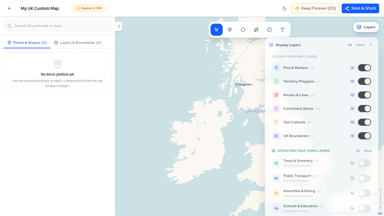
The Postcodewise Summer 2026 Mega Product Update: 35+ Releases, Map Studio, NaPTAN Transit, Conversational AI, and Sub-10ms Search
Over the last two months, the Postcodewise platform has undergone its most expansive transformation to date. Spanning more than 35 rapid releases (v2.13 through v2.49), we have introduced Map Studio, full official NaPTAN transit integration, Conversational Location Intelligence, sub-10ms Typesense search, Defra noise contours, BGS ground hazards, and our official Model Context Protocol (MCP) server. Here is an exhaustive breakdown of everything we have built.
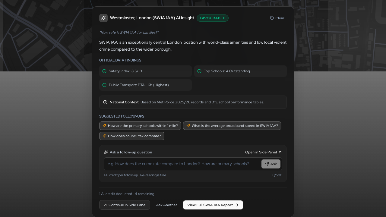
Conversational Location Intelligence: Ask Any UK Postcode Question in Natural Language
Say goodbye to digging through dozens of disjointed data tables. With Postcodewise Conversational AI, you can ask complex questions about UK postcodes in plain English—from family suitability and school catchments to rental yield comparisons—and receive instant, verified answers grounded in official open government data.
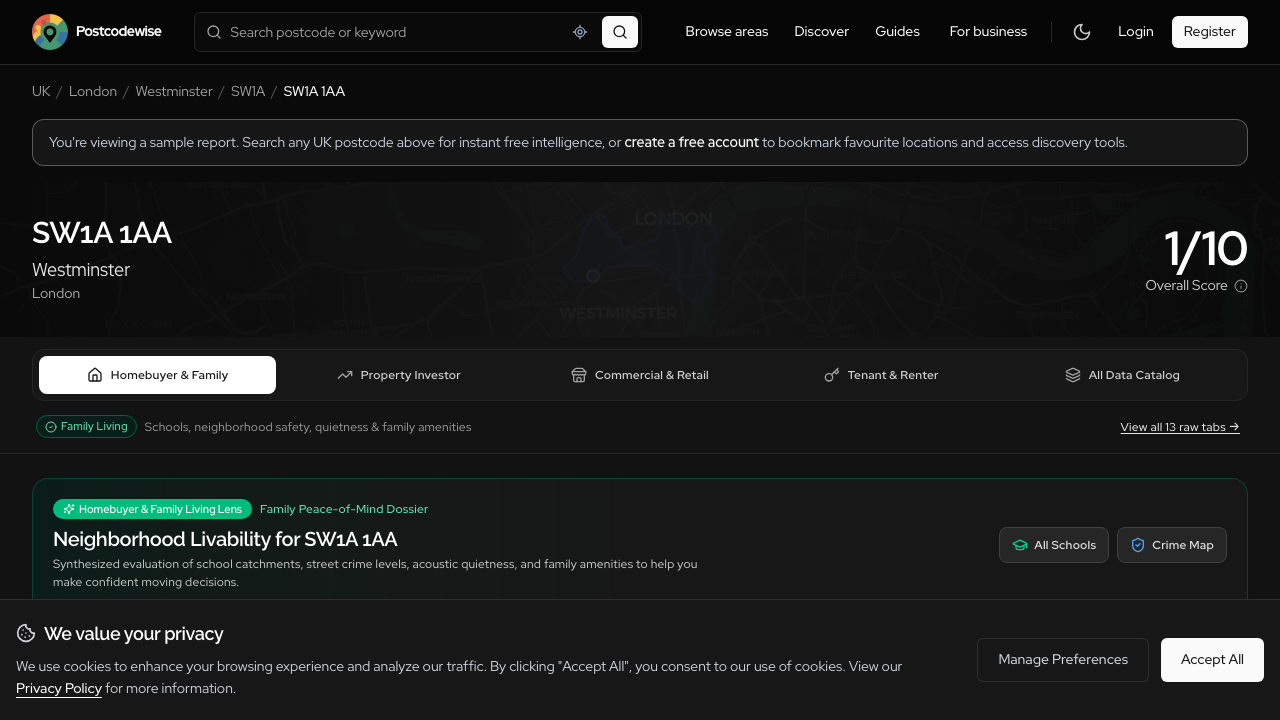
Introducing Audience Lenses: Tailored Location Intelligence for Buyers, Investors, Businesses, and Surveyors
A family evaluating schools needs completely different insights than a buy-to-let investor assessing gross yields or a surveyor checking subsidence hazards. Introducing Audience Lenses: four purpose-built analytical perspectives available across Postcodes, Districts, Wards, Comparisons, and Guides.
Experience these features on your own postcode
Search any UK postcode to explore conversational location AI, school catchments, crime trends, planning applications, and ground hazards.